Ice Age Trail (IAT) - Merrimac Segment

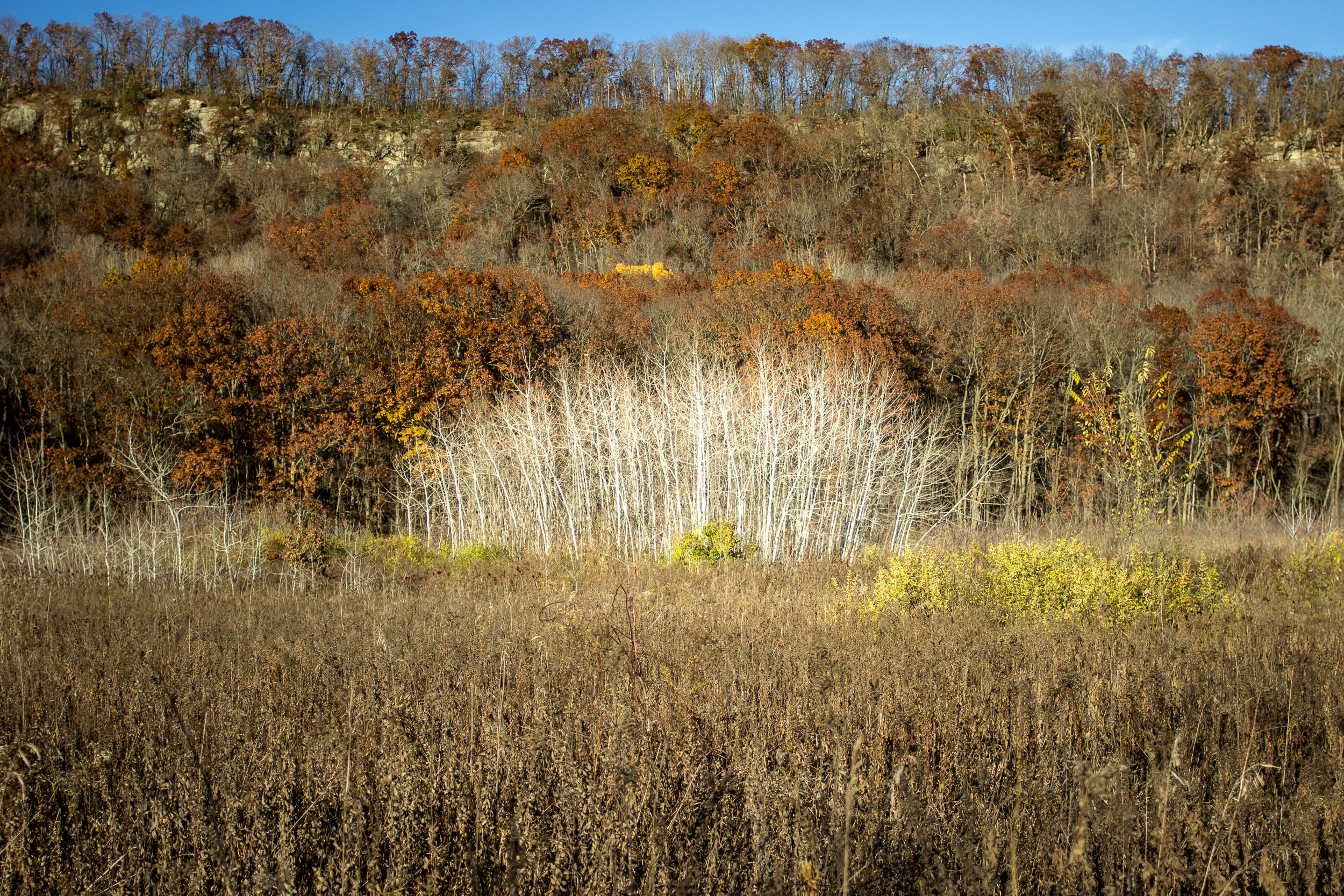
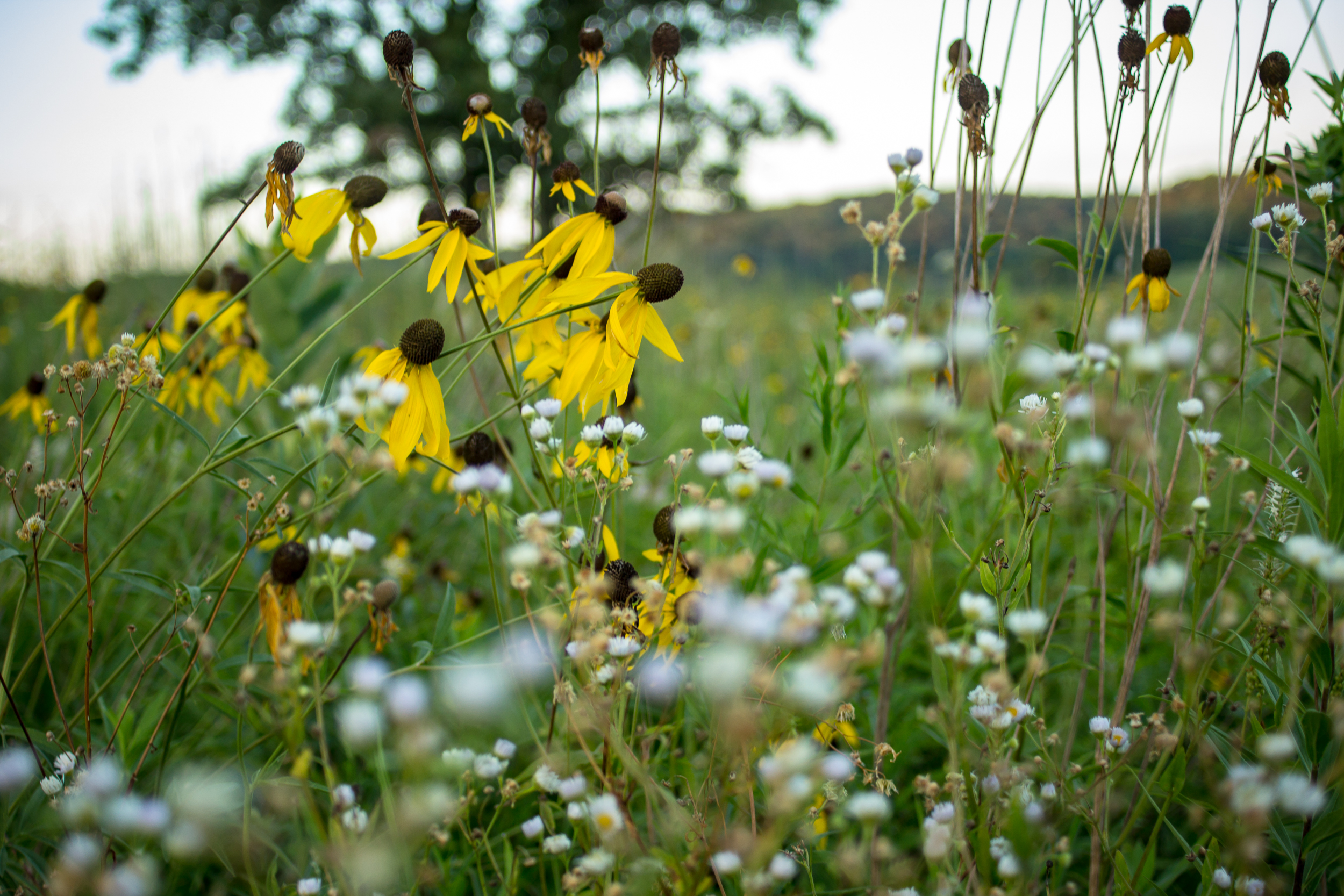
On the border of Devil’s Lake State Park sits a quiet section of the Ice Age Trail in the Merrimac Preserve. This section is 3.5 miles each way through oak savannah with views of the Baraboo Bluffs in the distance. In total, the Merrimac Preserve has ~10 miles of trail giving you many loop options. The few people and wide trails make this a favorite of mine for trail running.

Today I did an out and back parking at the IAT Merrimac Trailhead with my turnaround point at the IAT Roznos Meadows Trailhead. The Merrimac TH is almost always a better parking option. It’s less crowded and you don’t need a state park sticker.

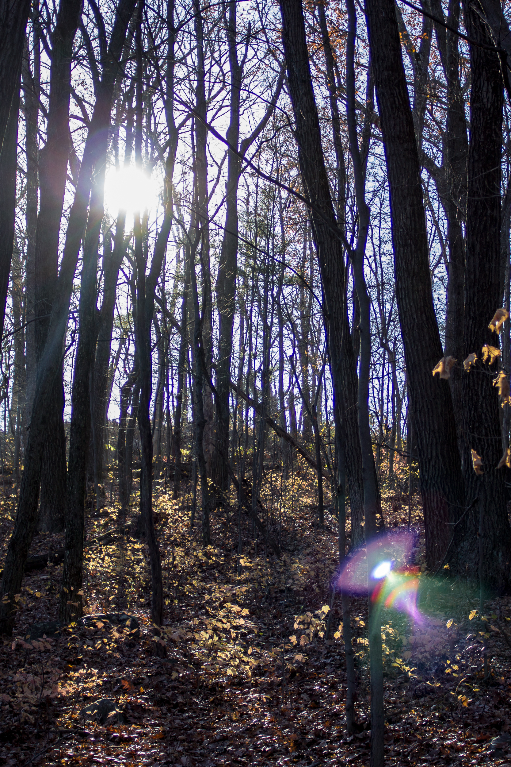
For the first of November, the weather is surprisingly warm and sunny. The hike begins by walking through thick oak and hickory forest. After 1.5 miles you pop out into a meadow and cross a road getting good views of the bluffs. A bit past the trail junction, there is a warming hut for snowshoe and cross-country skiers. 

The rest of the trail is more open, with a boardwalk crossing a swamp and then back into the oak savannah. Roznos Meadows is surprisingly crowded today with cars parked along the shoulder of the road. The hikers must be heading into Devil’s Lake State Park because we’ve only seen a handful in the preserve. 

We turn around here and head back. Just before reaching the car, we are treated to a small garter snake sunning itself.  

Links:

Sneaky Wisconsin River Camp

It’s been a sedate summer. Most of the camping trips we had planned have been postponed. While it’s nice to focus on staying close to home the vibrate neighborhood festivals that make Madison so fun in the summer have been cancelled. To add to it, K and I both got new jobs at the end of June. With lack of other things to do we’ve thrown ourselves into them and barely taken a day off. 

Realizing it had been over a month since we slept in a tent - a crime in the summer, right? - we decided we needed to do something about it. Even if it was just for a night. So we took a short drive to the Lower Wisconsin Riverway

The LWR is the longest free-flowing stretch of river in the Midwest, 92 miles long. Leave No Trace camping is allowed on the sandbars. Most people access it by boat, but there are a few spots that you can park and walk a couple hundred yards to some great camping spots. We chose a spot near Arena, WI about an hour from Madison.

In total we were probably at this spot only about 14 hours. But it was a great recharge with great swimming, beaching and a spectacular sunset. 

If you go:

https://dnr.wisconsin.gov/topic/lands/lowerwisconsin

Madeline Island Lockdown Escape

How’s everyone holding up out there? It seems trivial to post about what I’m doing when so many are suffering, but I’ll give it a shot.

First off, I’m grateful all my friends and family are safe. There are a few silver linings to living in lockdown. My garden is looking fantastic. I’m caught up on all the shows I wanted to watch. 

But I’m going stir crazy. No friends and limiting my adventures hyper-locally is getting dull. With summer is going into full swing I figured/hoped a weekend camping trip is an ok socially distanced activity. 

If you pretend both the air and water temperature are 20 degrees warmer, Madeline Island can feel almost like you are somewhere tropical. The azure blue water of Lake Superior and sandy beaches certainly look the part.

Our pandemic splurge was a set of paddle boards. Big Bay Town Park was a nice spot to play with them. Lake Superior was calm and we played with them on the gentle waves. The next day we took them out on Big Bay Lagoon which was even better. The water was glass like and there were a number of nooks to check out.

There isn’t a lot of hiking in either Big Bay Town Park or the adjacent Big Bay State Park. But the roughly 1.5 mile boardwalk trail connecting the two parks is a nice stroll between the bay and the lagoon.

On our way home Lake Superior was again very calm and we took the paddle boards out to the sea caves in Apostle Islands National Lakeshore. It was an amazing trip, but I was too scared to bring my phone out on the open water. Sadly, no photos.

If you go:

Ice Age Trail (IAT) - Mecan River Segment

No one is going to confuse the rolling hills of Wisconsin as the more prominent peaks of the western states but there is a quiet subdued beauty here that is often overlooked. 

A bit over an hour from Madison is the Mecan section of the Ice Age National Scenic Trail. On an overcast late fall day it provides a nice hike through forest and open oak savanna.

2019-11 Mecan River-7.jpg

We start at the 6th Lane/Chicago Road trailhead and head south east. There is a surprising amount of snow in the forested section here. With the leaves gone we also get occasional views down to the river. 

2019-11 Mecan River-3.jpg

The trail then opens up into the oak savanna. I love the way oaks sprawl their limbs out from their trunks creating a canopy over of the trail. This would be a lovely spot on a warm summer day. 

2019-11 Mecan River-5.jpg
2019-11 Mecan River-8.jpg

When we reach the parking area on 9th Ave. we turn around and come back the way we came to the car for a total of about 7.5 miles. 

2019-11 Mecan River-4.jpg

I certainly am still coming to terms with the terrain of Wisconsin after living in Colorado and spending the summer hiking through the Pacific Northwest. But secret hikes like this help to ease the transition. 

If you go:

Mecan River TH

Map: Caltopo / Gaia

IAT Guidebook Sample

Ice Age Trail Alliance

Ice Age Trail - Devil's Lake Loop

I was feeling a little stir crazy and with an amazing weather day for November I decided to do my favorite section of the Ice Age Trail through the Baraboo Bluffs.

Blog 2016-11 DevilsLakeLoop-3635.jpg

There are a number of ways to make this a shorter loop within the park, but if you want to do the whole section of the IAT here’s how I did it.

You could walk the entire 15.5 miles starting (or ending) with a 2 mile road walk but what I chose to do was a bike shuttle. I parked at the Rozno’s Meadows Trailhead on HWY 113 and then biked the 2 miles to the Parfrey’s Glen Trailhead. It’s a mostly flat ride and the road is in good condition for the short bike (or walk if you choose).

Blog 2016-11 DevilsLakeLoop-3698.jpg

Once you get to Parfrey’s Glen there is good signage on what trail is the Sauk Point Trail (the Ice Age Trail) and what is the trail up the glen, a fun side trip or a trip for another day. This section of the trail is uphill and mostly wooded. Near the top the trail opens up with views of Lake Wisconsin to the south.

Blog 2016-11 DevilsLakeLoop-3625.jpg

Crossing 113 after 4.5 miles from Parfrey’s Glen you’ll now be in the main portion of Devil’s Lake State Park and there are many options to shorten or take different trails. To stay on the official IAT trail route bear right (NW) onto the Uplands Trail Loop. A little less than a mile later bear to the right again (N) onto the Johnson Moraine Loop.

Blog 2016-11 DevilsLakeLoop-3684.jpg

After 1.4 miles this trail enters a campground where it can be confusing to follow the trail itself. I always have issues figuring out if I’m supposed to be on a trail or a road here, but both lead to the same place and the trail becomes more clear near the amphitheater. From here it heads down to the north shore of the lake (and concessions!).

Blog 2016-11 DevilsLakeLoop-3657.jpg
Blog 2016-11 DevilsLakeLoop-3669.jpg

Head through the picnic area and onto the West Bluff Trail. This trail will give you the best views of the lake as you head up and along the ridge. There are lots of great areas for stopping for views or enjoying some lunch. Head down the the bluff and down to the southwest shore of the lake. At the boat launch there are bathrooms.

Blog 2016-11 DevilsLakeLoop-3627.jpg

From here to the south shore the walk is along a sidewalk at lake level. The south shore has concessions and many picnic areas for stopping at. Not a bad idea to take a little break here as the trail steeply ascends the east bluff next. Once on top of the bluff you’ll walk along the ridge getting view of Devil’s Lake at first and then southeast towards Lake Wisconsin.

Blog 2016-11 DevilsLakeLoop-3693.jpg

The trail starts to descend back into the forest and finally into Rozno’s meadows for the last 1.5 miles back to the trailhead where you started.

If you go:

Ice Age Trail - Table Bluff Segment

We are lucky enough to have one of the National Scenic Trails running through Wisconsin. It’ll never be confused with some of its larger and more popular cousins, but its proximity to Madison gives us some good opportunities to get out on the trail.

A new section for me is the Table Bluff section of trail near Cross Plains, WI (and also where the headquarters of the IAT is located). Running 2.3 miles total it makes for a nice 4.6 mile out and back. Being in the driftless area of Wisconsin it’s more hilly than a few miles farther east and although it’s not very far from Madison itself it feels more secluded than you’d think.

Blog 2016-08 Table Bluff-3085.jpg

Starting from the south end you face a 200ft climb right to the top of an oak savanna. There is a nice picnic area at the top and views of the surrounding farmland. As you continue on the trail it weaves through forest, prairie and some farmland.

Blog 2016-08 Table Bluff-3093.jpg

The trail ends at Table Bluff Rd near Dreamfarm which specializes in local cheeses, eggs and veg (although they don’t have a farm stand). If you’re lucky enough you’ll see the goats and chickens galavanting in the fields.

At this point you can turn around and head back to the car along the same trail you came on.

Blog 2016-08 Table Bluff-3100.jpg

Floating on the Wisconsin River

Back at it with my uncle. This time a quick one night trip canoe camping on the Wisconsin River (gotta play with that new canoe!)

Blog 2016-06 Canoe Trip-4926.jpg

We put in early afternoon at the public launch off of Highway A on Indian Trails Parkway, about 5 miles south of the Wisconsin Dells. Our take out point was about 10 miles downriver off of Levee Rd. About half of the distance twists and turns through the Pine Island State Wildlife Area.

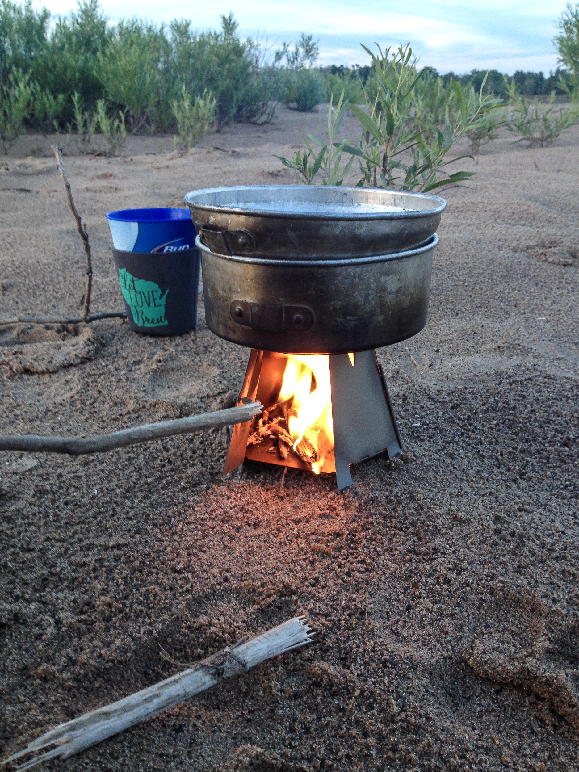
Fairly low key trip, saw a few eagles, hawks, herons and only a few people. As always, great to get out of the city for a day. Plus, I got to test out my new Vargo woodstove. It’s fairly fiddly but I think with some practice it’ll be a cool little stove.

 
Blog 2016-06 Canoe Trip-4950.jpg
 

Devil's Lake Loop

Growing up in Baraboo I’ve been to Devil’s Lake a lot. It’s a gem of southern Wisconsin. One of my favorite hikes is scaling both east and west bluffs and doing a loop of the lake. It’s about 6 miles, depending on which trails you take, and covers some of the more popular trails in the park. For Wisconsin the elevation gain of ~1,000ft is cool too… if you’re into that kind of thing.

Blog-DevilsLake-0318.jpg
Blog-DevilsLake-0333.jpg

We started at the south shore parking lot and headed up the Balanced Rock Trail. This one will get your heart pumping. At the top we headed down the East Bluff Trail and along the north shore beach area. Pro Tip: If the concession stand is open you can break the hike up with snacks (or beer!).

Blog-DevilsLake-0331.jpg
Blog-DevilsLake-0299.jpg

From here we headed up the West Bluff Trail to the highest point of the hike and then down along the lake back to the south shore. There is also a concession stand here, but, Pro Tip #2: save the money and go get your cooler out of the car and enjoy a beer/picnic on the lake, you earned it.

If you go: