Mount Field National Park Weekend

One thing I love about Tasmania (and New Zealand for that matter) is the walking club culture. The vibe is similar to a casual community or church potluck, except with a bunch of hikers. Like the community potluck, the makeup of these groups spans all ages and abilities. 

From my experience, these types of large tent groups are rare in the US. Meetups have a similar openness but are too decentralized to achieve a strong community vibe. More formal groups often are hyper-focused on a specific activity, age group, or cause. Maybe it’s just like that in the midwest though 🤷.

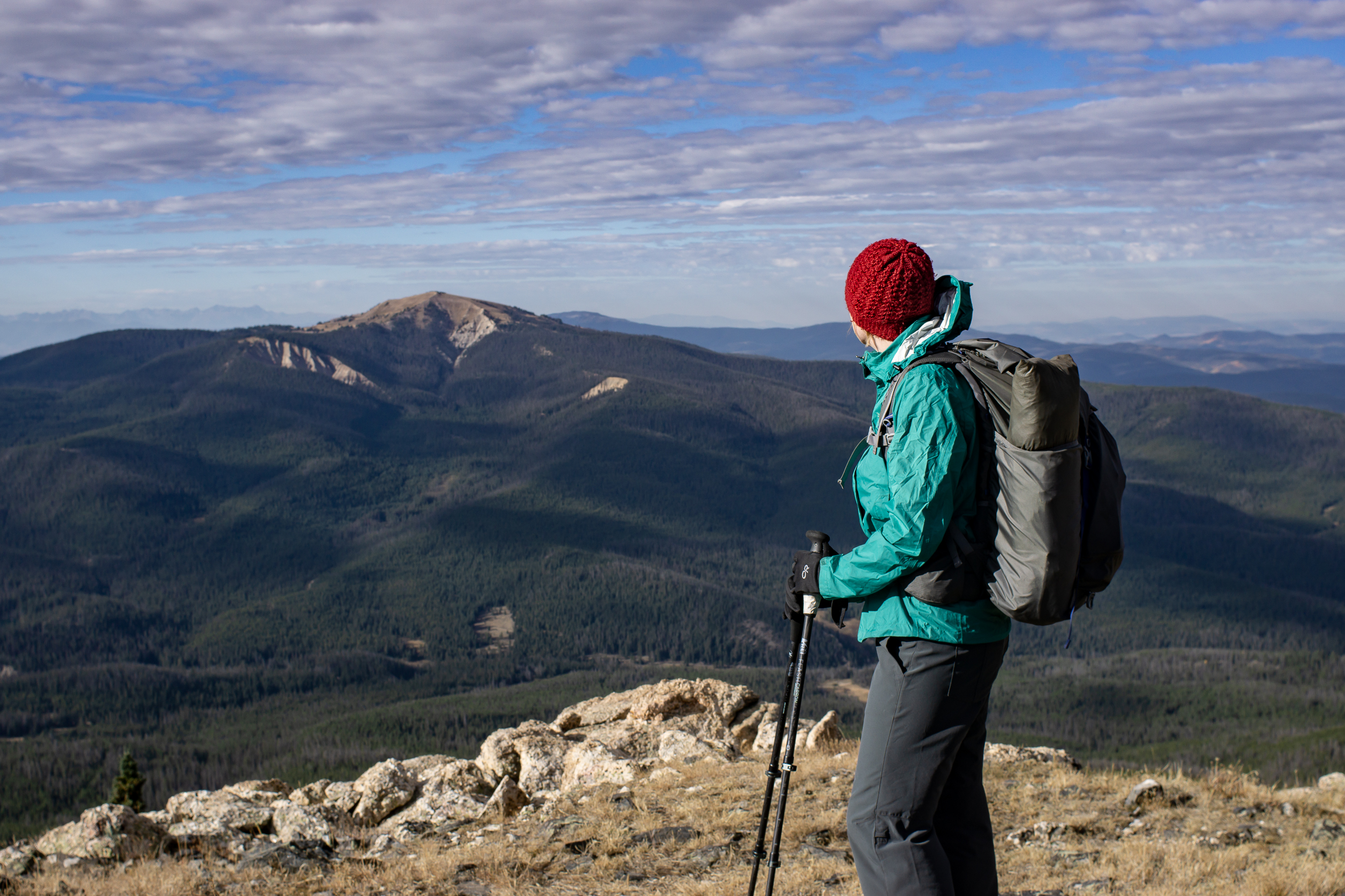
Over the weekend, we went to Mount Field National Park with the Hobart Walking Club. The club has been around since 1929 and has over 800 members. Almost every weekend there is at least one trip planned. Each is organized by a leader and assigned a difficulty rating.

Our trip is an induction weekend for newcomers. There are day hikes each day and the best part is we get to stay at the private club hut near Mt Dobson. The hut has been mostly unchanged since the 1960s due to park regulations limiting the types of repairs the club can do. 

The first day we did an out and back hike to the Tarn Shelf to get views and see the alpine Fagus (beech family) bushes changing color for the autumn. 

The trail starts with a steep climb past the ski area and onto a ridge. After that, it’s a mix of walking on boardwalk and trails with expansive views into the wild, untamed western side of Tasmania. The changing color adds a pop to the scenery but compared to autumn in the deciduous forests of Wisconsin, it’s a bit of a letdown. 

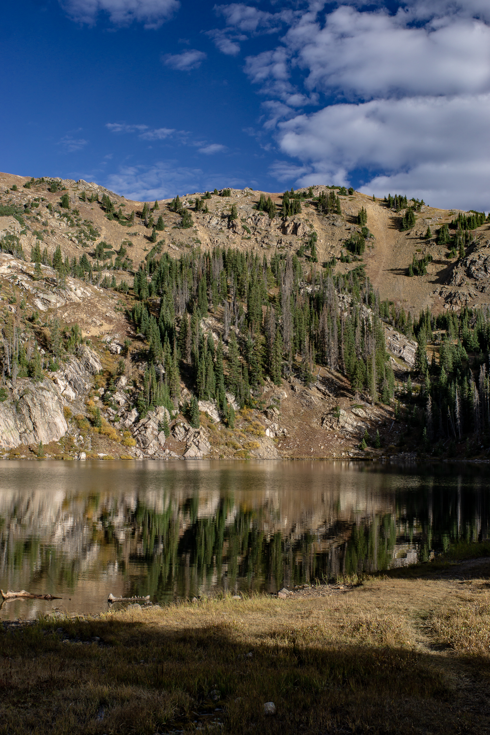
The next day, after an evening cozying up next to the woodstove and talking with the other club members, we set off on a longer hike to Lake Webster & Lake Fenton. A short car shuttle is needed for this hike, but well worth it. These tracks are less traveled, through thick forest and underbrush. The going is slow, but it gives us a chance to chat as we go along.

About 4 miles in we find a pleasant spot to take a break near an open field. All seems fine for the first 5 minutes until an itching sensation hits our feet. Leeches! We pack up and get out there fast. Overall only 1 or 2 bites in the group, nothing like my trip to Ben Nevis years ago.

Near the trailhead, we find a rockier spot (not leech territory) to sit and look over the lake. On the way out of the park, we take the quick 10 min walk to Russell Falls before heading home.

Links:

McKeever Cabin

I’ve been feeling a little stuck in Madison this winter. I’ve been doing a lot of cross country skiing since I (foolishly?) signed up for the 55km Birkie ski race, but I’ve been lacking in backcountry adventures.

Luckily, my uncle suggested we try the McKeever cabin in the UP. It’s only a 1.33 miles snowshoe back to the cabin but it’s a great cure for my backcountry craving. Wide open skies, freshly groomed trails, toasty fires and backcountry bloodies, it’s even better than I expected.

McKeever.jpg

I wasn’t sure what to expect on the ski front, it says groomed on the website but you just never know. Turns out they were excellent! They are groomed approx. once a week. We were lucky enough to have that day fall on our first day there. Not a huge trail system but three nice loops kept me satisfied. The cabin is situated in the middle of them, which means a mid-ski stop for snacks and a bloody mary.

IMG_7165.JPG
IMG_7158.JPG
McKeever-3.jpg

The cabin itself is small, has four bunks and a nice woodburning stove. It’s similar to the ones in the Porcupine Mountains on the other side of the peninsula. The stove is either on full blast or not on so it’s a bit a of a trick getting it just right. The best is there is an old hand water pump that works in the winter. A huge bonus. No melting snow for water. We met a ranger who stopped by to test the water, which they do every month, and she confirmed it was safe to drink unfiltered.

IMG_7200.JPG

I also go to dust off the pulk I built for a Thanksgiving Hut trip a few years back. It was much easier to pull on the mostly level trail vs up the side of a mountain in Colorado. Shocking.

IMG_7162.JPG
IMG_7142.JPG

I credit my uncle for inspiring my love of the outdoors, especially backcountry pursuits. He taught me many skills but also to not to take it too seriously. And never, ever, skimp on food. For this trip we had bloodies, ribs and a smorgasbord of other delights. On past trips we’ve had backcountry surf & turf and tacos. It’s always great to get out there with him (and my cousin!). He’s 68 and still crushing it. Champion.

IMG_7197.JPG
McKeever-2.jpg

Never Summer Wilderness Weekend

It feels appropriate to ring in the fall equinox in the Never Summer Wilderness. I wasn’t sure what to expect here having not read much about it (and really I shouldn’t be surprised) but, wow, it was an excellent trip. Scenery was top notch, it was only 2 hours from my door to the trailhead for an amazing weekend loop. And the bonus: from Boulder the fastest way is to take the Trail Ridge Road through Rocky Mountain National Park. Not. Bad.

Never Summer Wilderness-01017.jpg

We hit the trail the first day around 11ish (yes we are lazy). From the parking lot the trail skirts the side of the mountain until it intersection with the Bowen Trail, which is also part of the CDT! From here we began to climb up Bowen Gulch. Our total gain was 2,800ft over 8 miles but given the consistent increase it didn’t feel too bad. We split off the CDT onto the Bowen Lake Trail for the last 1.25 mi to get to Bowen Lake, a great place to set up camp and chill for a few hours before sunset. There were a few people around but it really wasn’t busy. The hike up was mostly through the forest, not much for long views but a very pleasant hike, especially with the aspens starting to change. Scenery at the lake opened up a bit and we could see the ridge we were taking the next day.

2018 Never Summer Wilderness-01039.jpg
Never Summer Wilderness-01050.jpg

Day 2 we hit the trail early and got up onto the ridge behind Bowen Lake, the Cascade Mt Trail. The ridge section is about 4 miles and there are amazing views in every direction. And a summit of Cascade and Ruby Mt if you choose to (the trail itself goes just below the summits). The trail is easy to follow, in a few sections it became faint but since we were following a ridge, no problem.

Never Summer Wilderness-01086.jpg
Never Summer Wilderness-01078.jpg
Never Summer Wilderness-01111.jpg

The ridge descends down to Bowen Pass and intersects with the CDT/Bowen Trail. We headed west on the CDT for a ¼ mile before the intersection of the Jack Park (?) trail. There is a small creek here and it provided a sunny spot for lunch. The trail winds up the side of Fairview Mt and after a mile we bore right at another unnamed trail junction. We headed up to the pass between Fairview Mt and Parika Peak getting good views along the way. At the pass we could see down to Parika Lake and the Baker Gulch, our way back to the car. Parika Lake is exposed and would make for a tough camp in windy weather if doing the loop in the other direction. There are more sheltered spots a bit farther down Baker Gulch near an unnamed lake at approx 11,000ft that would make a good camp. The walk out down the valley became mostly wooded and was similar to the Bowen Trail we took up.

Never Summer Wilderness-01171.jpg

Made it back to the car around 4pm, I was tempted to stop in Estes Park but I’m glad I was able to wait another 30 minutes to Lyons where we hit up the Oskar Blues Taphouse for a delicious burger and a beer.

If you go

Buffalo Peaks Wilderness Backpack

I wouldn’t call this loop challenging by any stretch of the imagination and the views are nice but not going to top any “best of” lists for Colorado. But when the more scenic trails are still covered in snow and you’re looking for an easy, pleasant weekend trip it does the trick. You could easily do this route as a day hike too.

The loop is 11.5 miles total with a net elevation gain of ~2,000ft and no steep climbs. It’s located just south of Fairplay, CO. Access is an easy 2WD gravel road.

We did the loop counter-clockwise starting from the Rich Creek trailhead. The trail is a steady uphill for the first 5 miles (most of the elevation gain for the hike) through aspen, pine and then a meadow: the high point of the hike.

2018-Buffalo Peaks Wilderness-00328.jpg

Just after the high point we started looking for camping spots. As you go downhill a small creek starts to form. I suspect as the season goes on this creek dries up. We chose a spot not too far off the trail here amongst the trees about 50 yards from the creek. Turns out there is a more popular (and flat) camping spot about a mile down the trail just before the Tumble Creek trail junction, but the privacy we had was worth it.

2018-Buffalo Peaks Wilderness-00281.jpg

On day 2 we spent the part of the morning looking for the Buffalo Ridge 1470 trail but we couldn’t find the access; it may have been partially under water as the marshy area was full with spring snowmelt. Regardless the area was fun, we saw turtles, beavers and many birds in and around the water.

2018-Buffalo Peaks Wilderness-00302.jpg
2018-Buffalo Peaks Wilderness-00309.jpg

We followed the Tumble Creek trail for the rest of the loop back to the car getting nice views of east and west Buffalo peak along the way. I’d certainly recommend this loop if you’re looking to get away from the crowds and have a relaxing backpacking trip.  

If you go:

Rich Creek TH

Maps: Caltopo / Gaia

USFS Buffalo Peaks information

Great Sand Dunes National Park

“Use the heater on the dash to warm up the turkey leftovers.” This is how our trip to Great Sand Dunes National Park started.

We had an unseasonably warm Thanksgiving weekend to get out and check out the dunes. The days are getting short, not much time left for hiking after a slow start and 4 hour drive from Boulder. Permits were easy to get, after talking with the ranger it seemed like we might be the only ones camping in the dunes tonight… Good sign? Bad sign? ¯\_(ツ)_/¯

BLOG-2017-12-02 GSDNP-09766.jpg

The basic backcountry instructions are to “go at least two ridges over from the visitor center, then camp wherever you want.” We took off from the parking area near the Medano Pass Road (which was closed) and hiked about 2 miles into the dunes before it started to get dark. The wind was intense but we managed to get the tent setup. I’m really glad we chose our heavier freestanding tent vs our Tarpent, which would have been near impossible to pitch in the dunes.

BLOG-2017-12-02 GSDNP-09665.jpg

Backpacking in the dunes is slow going, day 2 we made it a grand total of 5 miles. On top of the sand slowing us down we also were carrying all of our water for the day - there is no water in the dunes themselves and it was highly probable that we wouldn’t have water at the Aspen campsite either (there wasn’t).

BLOG-2017-12-02 GSDNP-09738.jpg

Early afternoon we exited the dunes and reached the Aspen campsite, aptly named as it is nestled in a grove of aspen trees with gorgeous views of the dunes and the mountains. It was much less windy here and with temps near 60 it was a great spot to lounge for the rest of the afternoon and enjoy the sunset.

BLOG-2017-12-02 GSDNP-1415.jpg
BLOG-2017-12-02 GSDNP-09815.jpg

We headed out early in the morning, using the last of our water to eat our breakfast and coffee. Little Medano Creek, our nearest water source, is about 1.75 miles from Aspen and we had a long break there refilling water and basking in the early morning sun. From here back to the car it’s about 5.5 miles and for the most part the sandy trail parallels the dunes. The last mile we chose walk on the 4WD road. The views were similar, just less sand.

BLOG-2017-12-02 GSDNP-09843.jpg

Speakers Cabin - Porcupine Mountains State Park

[Read about my 2021 trip to Speakers Cabin here]

The hike into Speakers Cabin is hardly constitutes a hike (it’s about a mile), but the cabin has arguably the best view of Lake Superior of all the cabins in the Porcupine Mts. It also sits on the Lake Superior Trail making for nice day walks in either direction.

SpeakersCabin-0989.jpg
SpeakersCabin-0987.jpg

About a foot of snow fall near Summit Peak a few days before had us daydreaming about some snowshoeing, but other than the drive from ranger station to the Speakers Trailhead there was no snow at lake level. (We did learn that our little 2WD RAV4 can power through the snow surprisingly well, yay!)

Arriving at the cabin in late afternoon we cranked up the woodburning stove and got it nice and toasty. Then, glancing through the log book, we noticed multiple warnings to NOT get it too hot. Why? If it gets too toasty hundreds of flies resurrect and delight in the warmth… It was already too late, the buzzing had begun. We spent the rest of the weekend trying to find the sweet spot of keeping warm but not so warm that the flies would come back to life.


After the fly drama we settled into a relaxing night looking at the many guidebooks left in the cabin and a few board games we packed in (the luxuries of a one mile hike).

On day two we did the short 2-ish mile hike to the Presque Isle scenic area. It was fairly flat and had a decent amount of water on the trail, likely from the storm that dumped the snow higher up. The hemlock trees lended a spooky ambiance on an overcast day.

SpeakersCabin-1018.jpg

Had lunch at the falls, ambled back to the cabin and were treated to a gorgeous sunset before heading back in to a warm (but not too warm) cabin. The next morning we headed back to the car and back home.